
PRAXIS SCIENCE LAB / ANDROID
TerraLab GPS Tools — Publishing Materials
English listing, data inventory, graphics and release checks.
Preparation materials, not a submission or Google approval. Use these fields only for a verified release with the described functionality.
| Field | Prepared value / action |
|---|---|
| Title | TerraLab GPS Tools |
| Package | app.praxis.terralab |
| Reviewed version | 0.2.0 (3) |
| Publisher | Praxis Science Lab |
| Support email | traiananghel@gmail.com |
| Suggested category | Tools |
| App access | No login or restricted account access |
| Ads | Google sample ads in the development build only. Commercial monetization and production consent configuration are not enabled. |
| Target audience and IARC | Answer from the real intended audience and final content. No age rating has been assigned here. |
| Health declaration | No health functionality in the reviewed scope; complete the form accurately |
English listing
Short description
GPS, compass, satellites, weather and offline maps for your next journey.
Full description
Your Android field toolkit, with a dark instrument-panel interface and direct access to location and device sensors.
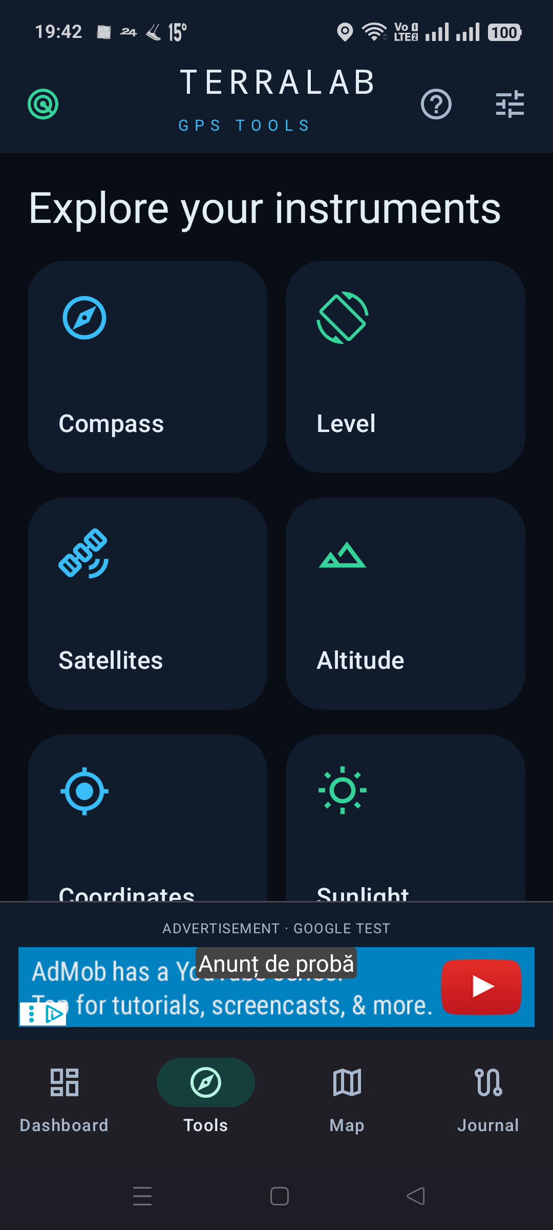
Read speed, coordinates, accuracy and GPS altitude. Explore a digital compass, bubble level, GNSS skyplot and satellite signal bars. Pressure readings are available on devices with a barometer. Sunrise and sunset are calculated locally.
Record tracks with pause and resume, including screen-off recording through an Android notification. Save waypoints, review track statistics and import or export GPX files. Your routes remain on the device unless you export them.
Load a forecast from MET Norway for coordinates you choose. View temperature, wind, humidity, pressure, precipitation intervals and hourly or multi-day outlooks. The last forecast remains readable offline with its location and retrieval time. A new forecast requires internet.
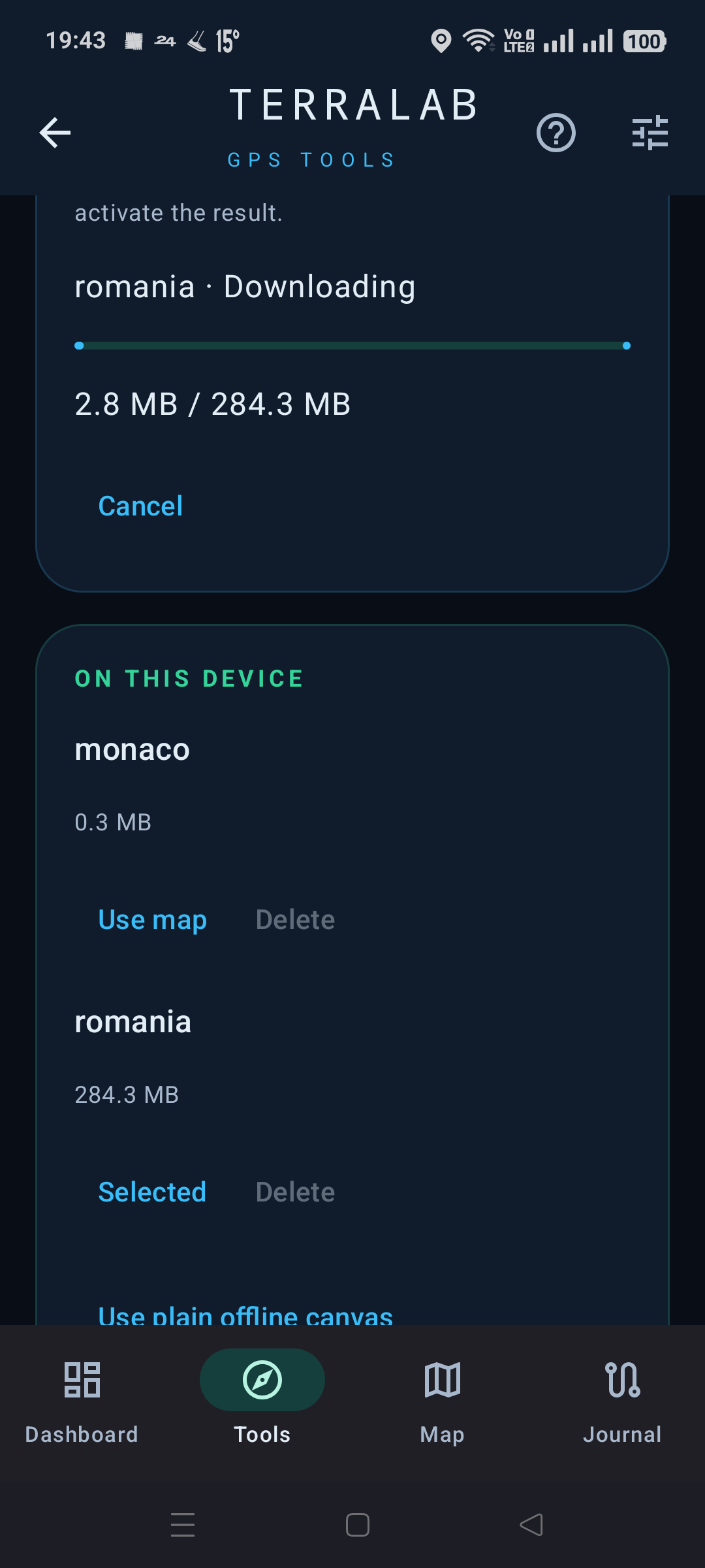
Download Mapsforge country packages or import a .map file, then select it for fully offline map rendering. The current download menu includes Romania, Spain, Bulgaria, Hungary, Moldova and Monaco, with a 1 GiB limit per package. Use the map for points, tracks and approximate distance or area measurements. Online OpenStreetMap is optional.
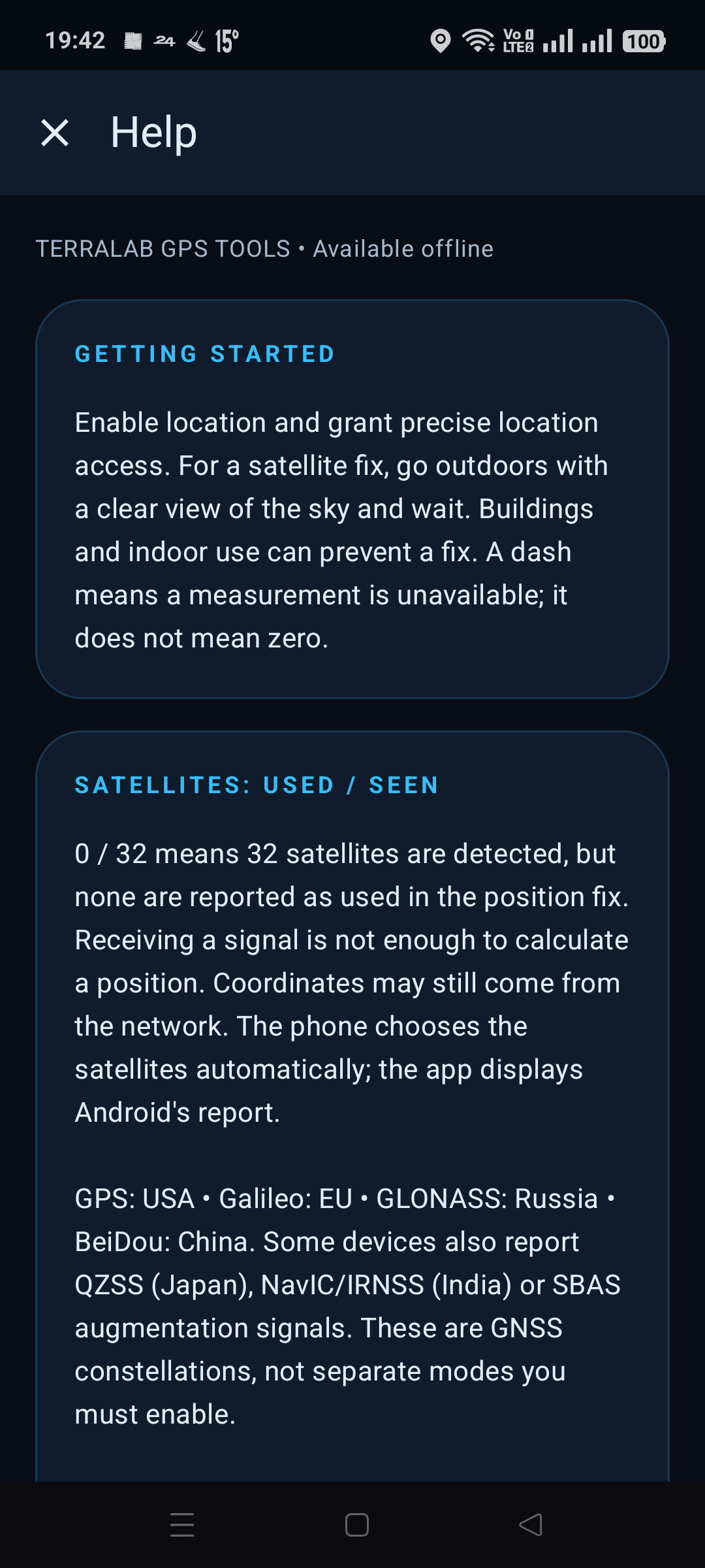
An offline Help guide explains the instruments, satellites and available features. English, Romanian and Spanish are included.
Version 0.2.0 is a development build with Google sample banner and interstitial ads. Commercial advertising and a Google Play release are not configured.
Data safety worksheet
Review the exact release artifact and all providers before making Play Console declarations. Local track storage does not imply no network data handling: weather, online maps, requested package downloads and Google sample advertising have separate data flows.
Location and sensor readings are processed on the device. Tracks, waypoints, settings, downloaded maps and the last weather forecast are stored locally. There is no app account or developer-operated backend.
GPX import and export use the Android document picker. Exported files can contain exact positions and timestamps; you choose their destination. Files imported as Mapsforge packages are validated before activation.
Location permission supports positioning, GNSS and track recording. Recording is started explicitly and can continue with the screen off through a foreground service and visible notification. No always-on background-location permission is requested for ordinary use.
Loading weather explicitly sends the chosen coordinates rounded to 0.01 degrees and the connection IP to MET Norway (api.met.no). Responses are cached; requests respect provider cache and retry limits. There is no periodic weather polling in the background.
Enabling the online map contacts tile.openstreetmap.org and reveals the viewed map area and IP address. Offline package downloads contact the Mapsforge Hochschule Esslingen mirror with the selected package and IP, not GPS coordinates. Android DownloadManager can continue a requested transfer in the background. Installed packages render without internet.
The development build includes Google Mobile Ads and requests Google sample ads. Google may process connection information, identifiers, interactions and diagnostics. Test ads do not generate revenue. The app does not explicitly pass GPS tracks to its advertising controller. Production advertising IDs and the applicable consent configuration remain unconfigured. Google privacy policy: https://policies.google.com/privacy .
Media
Capture at least two authentic screenshots from the final app. Do not use simulated screens, synthetic medical fixtures or old-brand captures. Screenshot language must reflect the actual app; English captions do not imply an English-only interface.
Actual Android test-build captures, prepared for listing review. Recheck against the final upload build.
Remaining release checks
- Prepare production signing and a verified store release.
- Complete representative outdoor GPS recording and device testing.
- Review weather-provider scaling and caching before broad distribution.
- Configure production advertising and applicable consent before monetization.
- Complete release-specific Play Console declarations, graphics and review.